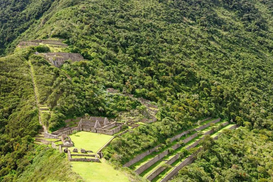
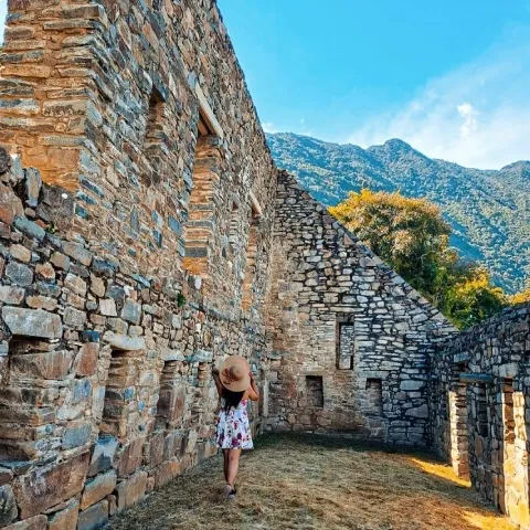
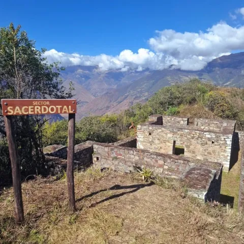
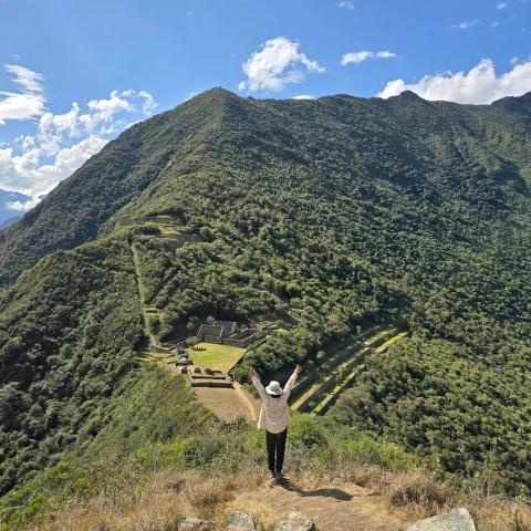
Choquequirao attracts the attention of tourists, facing Machu Picchu. One of the most important archaeological monuments of the Cusco region and the country, Choquequirao was an Inca Llaqta that functioned as a checkpoint between the jungle and highlands, waiting to be discovered by you.
Located in the department of Cusco, province of La Convención, this place is home to many architectural charms that enclose unique and incredible stories within its streets and buildings.
These stories are often told loudly by the architectural space during the tour. Built during the time of Tupaq Inca Yupanqui, Choquequirao remains intact as a symbol of power, with its imposing terraces, temples, Huacas, and Qolcas, offering its visitors a warm welcome.
What is Choquequirao?
The term Choquequirao comes from the Aymara words chuqui=gold and the Quechua k'iraw=cuna, which, when translated into Spanish, means "cradle of gold".
It refers to the reflection that the sun’s rays cause when they reflect off the micaceous schist used to build the architectural structures, creating a golden hue in the distance during the day.
Studies to date mention that Choquequirao must have been built in the time of Tupaq Inca Yupanqui, at a time of dynamic Inka expansion, although some mention that it was the great Pachakuteq, who would have built such an important site.
However, we accept both possibilities because both rulers governed the Tawantinsuyo. While Tupaq Yupanqui carried out the great expansionist campaigns, Pachakuteq focused on magnifying Cusco, promoting the cult to their Gods, and organizing the "mitmas" in the lands that the Tawantinsuyu incorporated.
Interesting Construction of Choquequirao
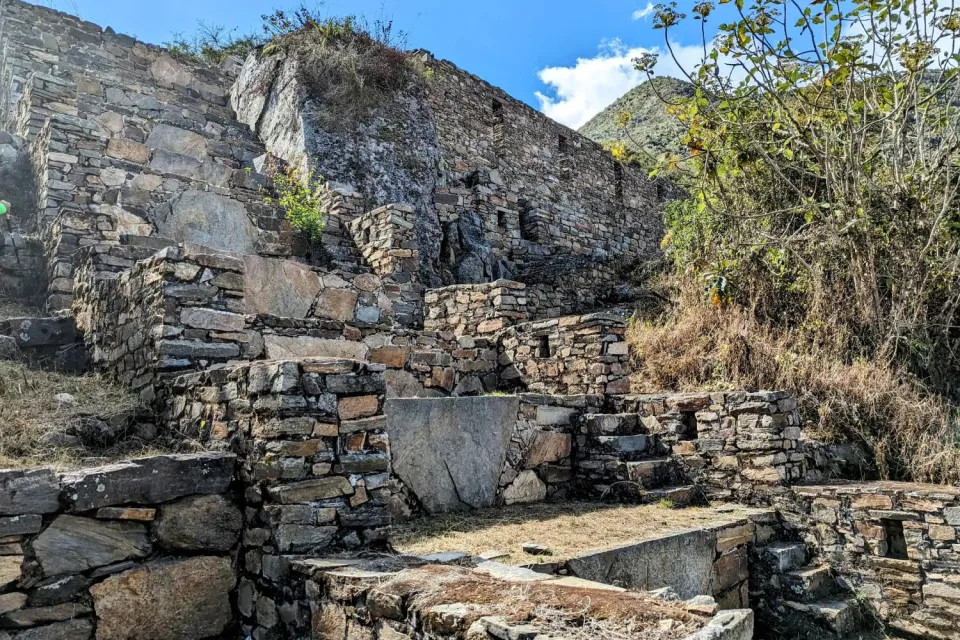
Regarding the architectural construction of the archaeological site, there is evidence of a change in the construction material and, to a lesser extent, a variation in the design. We can see these changes in the variation of lithic material (schist) used for construction. The highest quality schist (with little mica) was used in the earliest buildings, while builders used lower quality schist (with more mica) on a larger scale for constructing walls and enclosures that were incorporated into the existing structures.
Builders used lower quality schists (with a high mica content) on a larger scale for constructing walls and enclosures that were incorporated into both the existing structures and the new construction sections.
Thus, Choquequirao is a llaqta that was not architecturally completed. Based on these results, we propose that the initial social and agricultural infrastructure of Choquequirao changed functionally by introducing new spaces, developed sequentially and today called subsectors, such as "Paqchayoq," which stands out due to its unique rigging.
History
Pre-inca
According to the latest archaeological research in Choquequirao there is evidence of occupation by the "Antis", among them the "Manaríes and Pilcozones".
Who were the first settlers in this territory, to then be occupied by the Killke of the Late Intermediate (1000-1200 AD), which expanded into the valley of Cusco, Anta, Urubamba (archaeological site of Ancasmarca), Vilcabamba valley (archaeological site of Qoriwayrachina), then it was occupied by the Incas.
Inca
During the Inca occupation under Tupac Yupanqui, they called Choquequirao the nation of the "Quechuas," and it became part of the territory of Pachakuteq, who conducted "reconquest" campaigns. He succeeded in establishing large-scale coca leaf plantations, which later served as an access control point to the jungle for exotic bird feathers and other spices used as offerings and ornaments in the Inca's clothing.
After gaining territorial control, the Incas established a new economic, social, political, and administrative system. The natives adapted to a new architectural pattern imposed by Pachakuteq, the manager of the conquest of the "Antis" peoples.
During this time, the Incas transformed all this space into "moyas" and orchards of fruit trees, where they planted chili, coca, cotton, chichira (a hemostatic plant used to stop nosebleeds), vilca, snuff, and a sacred tree for the Indians called "wilka," which was known as the land of the sun.
They worked the land using the mita system, with the mitimaes from Quito or the "yungas Indians" planting and caring for these crops. This continued until 1534-1575, when the mitimaes returned to their hometowns, and some enlisted in the army of Manco Inca.
Important events.
- In the XV century "the Quechuas" were one of the largest and most powerful tribes of the Andes, which caused the famous civil war between the Chancas-Incas, who occupied the Apurimac river basin.
- In 1572, the transition period, choquequirao is considered as one of the last Inca resistance llaqtas of Tupac Amaru I, which by orders of Manco Inca, left the city of Cusco and then took refuge in the region of Vilcabamba from where they resisted the attack of the Spanish, which culminated in his capture and execution.
The resistance of Manco Inca.
In 1537, Manko Inca abandoned the city of Cusco and chose the Antisuyo area as a refuge and resistance against the Spaniards, where Manco Inca ruled with his sons supported by his captains who moved through the mountains and along the banks of the Mayomarca River.
During the colonial period, between 1537 and 1572, these lands were the domain of four Incas from Vilcabamba, starting with Manko Inca who died in 1544 at the hands of the Almagristas; Sayri Túpac left Vilcabamba after making a pact with the Spaniards; Titu Cusi Yupanqui who dictated a written chronicle and Felipe Túpac Amaru the last Inca of Vilcabamba, defeated and executed by order of Viceroy Francisco de Toledo in 1572.
Location
Choquequirao is located in the department of Cusco, within the territory of the Yanama Rural Community, Santa Teresa district, province of La Convención at an altitude of 3,105 masl, located 1,500 m above sea level on the Apurimac River.
When is the best time to travel to Choquequirao?
The best time to venture to travel and make long walks is in the months of April to October in which we do not have the presence of rain. You can see the Choquequirao Tours.
| 
|
Climate of Choquequirao.
The Choquequirao archaeological site has a climate:
- Temperate to warm dry, in the months of April to November.
- Rainy in the months of December to March.
Humid temperature of 25°C during the day and at night drops to 4°C, with an average temperature of 14°C.
Flora
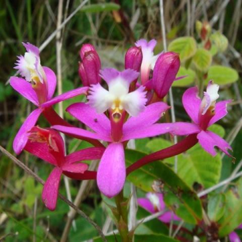
During the trip to the Choquequirao archeological site, you can observe endemic orchid varieties: Bletia catenula, Zaza. Zaza (Cyrtochilum aureum), waqanki (Masdevallia veitchiana), Telipogon Marleneae, among others; Pinco pinco (Ephedra rupestris), Kiswar (Buddleja coriacea), Queñoa (Polylepis tomentella), Achupalla (Puya herrerae), Sankayo or warako (Echinopsis maximiliana), etc.
Fauna
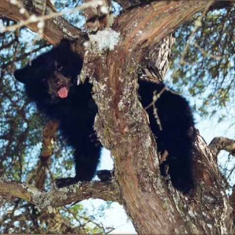
During the hike you can observe recurrent species in this landscape such as: Spectacled bear (tremarctos ornatus-ursidae), White-tailed deer (odocoileus peruvianus-cervidae), Andean fox (lycalopex culpaeus-canidae), Marsupial weasel (marmosops noctivagus), Hummingbird (trochilenae-Apodiformes), Swallow (Hirundo rustica-Passeriformes), Andean Condor (Vultur Gryphus- Chordata) and others typical of the Yunga montane forest, we have sixteen endemic species of amphibians and reptiles as well as twenty-one species of birds.
| 
|
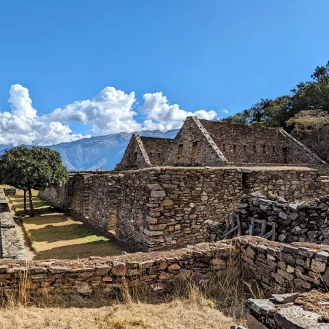
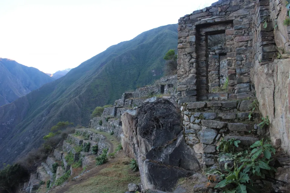
What you will see inside Choquequirao
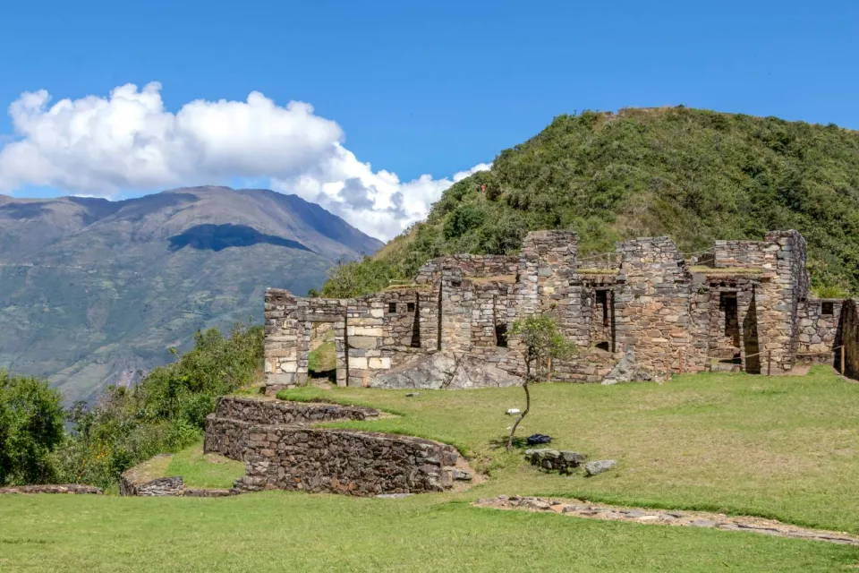
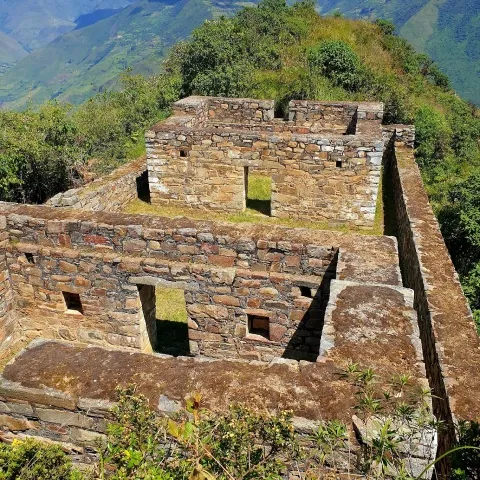
Hanan Temple
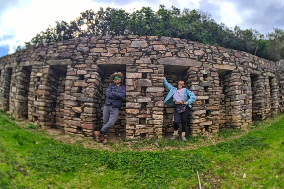
Located to the north of the main square in which it is observed: temples, enclosures of rectangular plant, water channels, colcas and a staggered paqcha, it is divided in two: Subsector A.
Located north of the upper plaza, composed of a building of 36.1 m2 with several corridors and platforms, quadrangular in shape with double jamb niche. Subsector B. It is located to the south of the upper plaza where there are three buildings placed contiguously.
| 
|
Deposits or Qolqas
They are located to the southeast of sector I, where nine platforms and five rectangular structures that served the function of storage of products, textiles and weapons to then be redistributed among the inhabitants of the population of Choquequirao are observed.
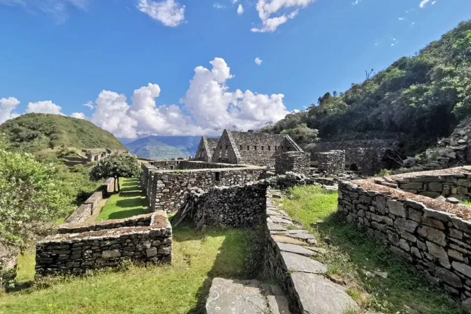
Main Plaza
They located it in the central part of the archaeological complex, referring to the open space, making it one of the main meeting centers where people held cultural and religious events of social use. Adjacent to it, you can observe nine structures with a rectangular plan and four terraces.
Portadas
Considered as a sacred monument, dedicated to the ancestors, located south of the main square, referring to the four double jamb niches that represent a sacred space, this sector is a space for ceremonial and religious events.
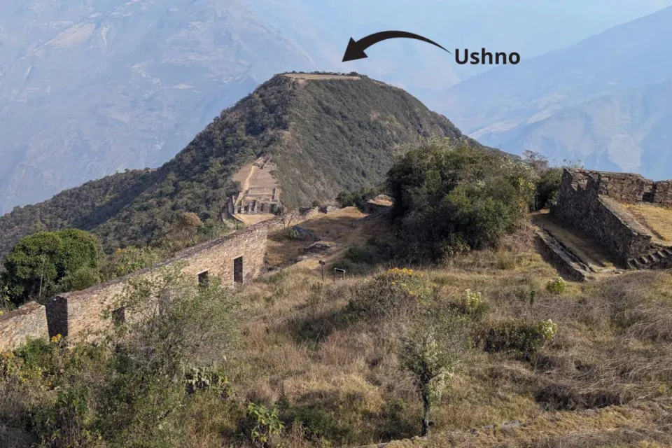
Ushno
They located it south of the main square, on top of a terraced hill bordered by a perimeter wall, referring to a ceremonial space where people made sacrifices and released liquid offerings as thanks for the land's production, serving as a political and religious site.
"Priests' dwelling.
They located it to the southwest of the Ushno, consisting of two rectangular buildings. This space served as a site for the preparation of priests who performed religious events, so they restricted access to this space.
| 
|
Sacred Platforms
Located northeast of the main square, formed by five retaining walls, being an agricultural space belonging to the lands of the sun.
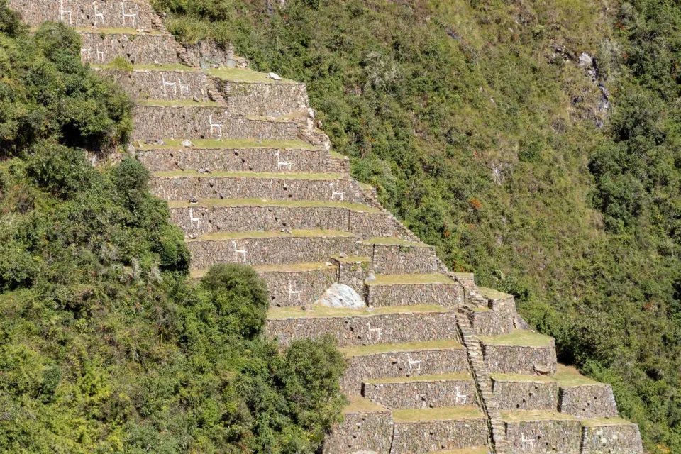
Llamas terraces
They located it to the west of the main square in the lower part of the hillside, at an altitude between 3020 and 2770 m.a.s.l.
There, they built sixteen platforms that feature 16 zoomorphic and anthropomorphic figures, as well as geometric lines of camelids and a muleteer made with white limestone. These figures have a more stylistic than agricultural function, adapting to the topography of the land.
Pikiwasi or Administrative sector
Located to the southeast of the main square, composed of sixteen buildings of different sizes and disposition, buildings that correspond to a social-domestic function.
Paraqtepata
Formed by 18 terraces and 5 sections of terraces for crops accompanied with water channels for irrigation, it is located on top of one of the landslide zones that projects on the right bank of the Ch'unchumayu stream.
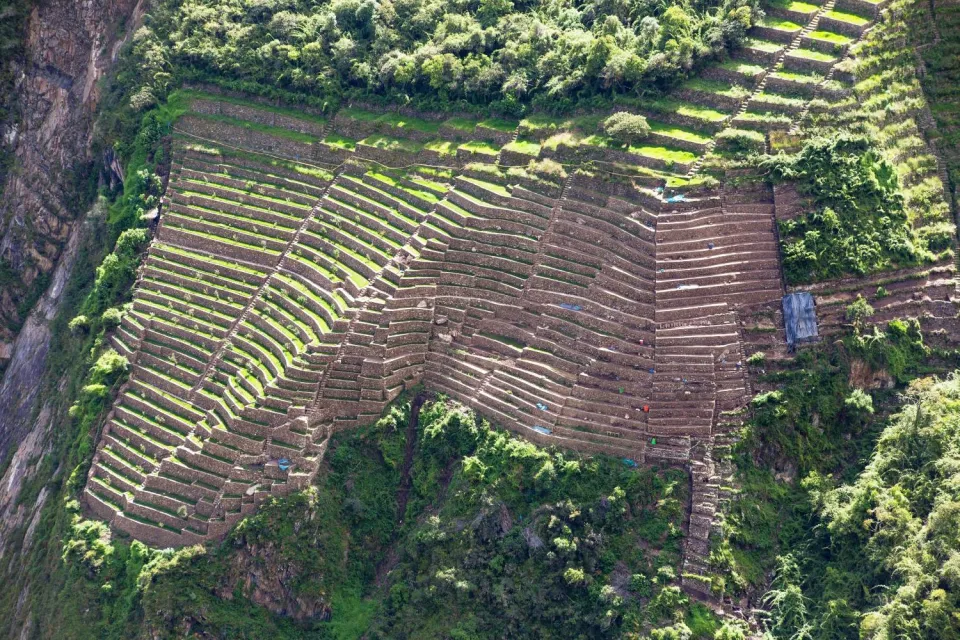
Phaqchayoq
They located it in the middle part of the right bank of the Ch'unchumayu stream. It consists of a large set of cultivation terraces that occupy an area of 5.7 hectares for agricultural use.
They also observed "the house of water," which served as a ceremonial place where they worshiped the water that comes from the snowy mountains.
Pinchaunuyoq
Located on the northwest side of the archaeological site of Choquequirao on the road to the site of Cotakoka, where you can see cultivation terraces, a three-hour trip by bridle path.
Choquequirao vs. Other Inca Ruins
The mitimaes brought during the government of Inca Pachacuti used lithic material of stone slabs and decorative walls at the archaeological site of Choquequirao. These walls present similar characteristics to the decorative techniques at the archaeological sites of Kuelap and Pajaten in the Chachapoyas style.
Historians mention that the Inca Pachacuti built Choquequirao and Machu Picchu at the same time with the same commemorative intention.
Both were constructed for the political and religious elite, with some differences related to their physical environment. The location in the upper part resulted from space management, allowing visual control of the surrounding area.
| 
|
Routes to Choquequirao
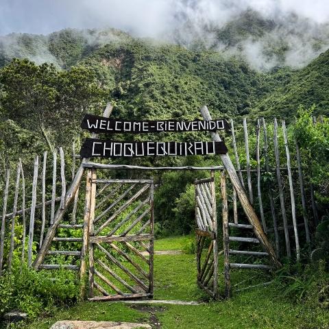
There is no excuse to travel to Choquequirao because we have different routes to go to this site.
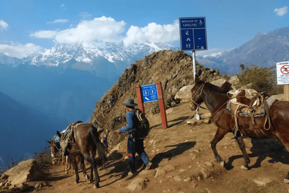
1. San Pedro de Cachora-Choquequirao:
Route with greater frequency, it begins in the populated center of San Pedro de Cachora in the km 151, in the asphalt road Cusco-Abancay, we continue a detour to the sector of Capuliyoc, to continue walking for Chiquisca, beach and bridge Rosalinas, until the sector Santa Rosa Baja and Alta, Marampata and finally the Archaeological Complex of Choquequirao approximately to 32 km of the town of Cachora.
2. Vilcabamba-Choquequirao:
Less frequented route that begins the hike in Huancacalle, in the District of Vilcabamba, which links to the pre-Hispanic road that goes to Choquequirao, traveling approximately 70 kilometers uphill.
3. Huanipaca-choquequirao:
A less frequented route that starts in the town of Huanipaca in the province of Abancay, on the paved Cusco-Abancay road Km 151, we continue on a dirt road to Tambobamba and the rural community of Kiuñalla, to the old hamlet of San Ignacio and the beach of the Apurimac River, and then ascend through a pedestrian path of 64 kilometers.
4. Mollepata-Choquequirao:
Route little frequented of 135.5 kilometers, that begins in the populated center of Mollepata, crosses the opening of the Salqantay peak arriving to the middle part of the valley of the Santa Teresa River, then to the Yanama Peasant Community and concludes in Choquequirao.
5. Machupicchu-Choquequirao:
Approximately 82.99 Km. traveled in 34 hours 20".
6. Santa Teresa-Choquequirao:
Approximately 76.54 Km traveled in 28 hours 40".
Cultural and Local Experience
Typical food and drink of the region:
These activities are historical and cultural traditions that were inherited from generation to generation through time typical of the area such as:
- Tallarin de casa con estofado de gallina (house noodles with chicken stew)
- Guinea pig pepian
- Guinea pig chactado
- Stuffed guinea pig
- Chicharrón de chancho (pork rinds)
- Chicha de jora: Ancestral drink made with corn, of Inca origin.
- Cambray: Liquid drink made in an artisanal way, since colonial times from sugar cane juice.
- Cañazo or aguardiente: Liquid drink extracted from the trunk of sugar cane made in an artisanal way belonging to the colonial era.
- Anisado: Handmade liquid drink where the main element is the cañazo, where green anise (Pimpinella anisum) from colonial times is added.
Interaction with the local community and how to support the local economy in a responsible way.
If you wish to stay a few more days in this unique landscape, it is recommended to develop the following.
- Experiential tourism: A local family will be ready to welcome you as a member, without making distinctions so that you can have the best experience of your life, experiencing the best experiences and adventures of coexistence.
- Ecotourism: If you are a lover of plants and animals Choquequirao is an environment conducive to interaction with nature by the existence of high biological diversity with the presence of habitats and microclimates of the place.
Nearby accommodations
There are safe places to spend the night:
- Capuliyoq
- Chiquiska
- Santa Rosa
- Rosalindas
- Maranpata
Practical tips:
Recommended tours and highlights within the site.
Once in the archaeological site, we recommend visiting: the Central Plaza, Hanan Temple, Las Portadas, Pikihuasi and the Ushnu; for those who love biodiversity, there is the sector of Las Llamitas, Paracteqpata and Pachayoq.
Tips to avoid crowds or to have the best experience.
Due to the extension of the archaeological site it is recommended to bring:
High mountain sneakers, overalls or light clothing, wide-brimmed hat , dark sunglasses, two walking sticks, a good camera , a binocular, water and snack and should not miss a backpack with: medicinal alcohol, a bandage, gauze, flashlight, medicine for colic, headache and muscle pain, a repellent and mosquito net as this site is habitat of mosquitoes to have a nice souvenir of the site.
Being at the site of Choquequirao you have to keep in mind
- Be very careful with the heritage, since these belong to everyone, not just to one person, and must prevail through time so that other generations can learn about their culture and history.
- Follow the arrows because with them we will continue the tour without missing a sector.
- Do not touch the lithics (stones), because they could be overlapped, causing some accidents.
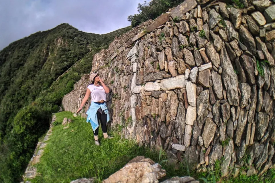
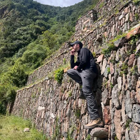
- Do not climb and lean on the walls, because with our personal weight we will increase the pressure on them, causing them to collapse (collapse).
- In case of losing the way to the group with which we are going, consult with the park rangers and redirect to where they are.
Frequently Asked Questions
- In what year were the first archaeological investigations carried out in Choquequirao?
In 1986, Architect Roberto Samanez Argumedo and Archaeologist Julinho Zapata Rodriguez carried out the "Proposal for the Restoration and Enhancement of the Archaeological Ensemble of Choquequirao".
- Because it is said that Choquequirao is the other Cusco.
Archaeologists Roberto Samanez and Julinho Zapata conducted studies and found that Choquequirao shares the same architectural design as the Inca city of Cusco. Both cities feature a dual organization, with the high sector or Hanan and the lower part or Hurin. Both Inca cities include temples, enclosures, terraces, ceremonial buildings, three two-level buildings, and two kallankas (Samanez and Zapata 1999: 90).
- Who was in charge of working the terraces of Choquequirao?
Due to its location, Choquequirao became a very productive land called the land of the sun, which the "mita" system worked. Pachacutec brought the mitimaes from Quito, or "yungas Indians" from Ecuador, to work and care for the land (Espinoza 1973: 90).
- Which characters were in Choquequirao?
The characters that arrived to the archaeological site for the first time were:
- 1710 the Spaniard Juan Arias Días Topete, who mentions that Choquequirao is an uninhabited town.
- 1834 Hiram Bingham, states that Choquequirao is Vitcos, occupied by the Vilcabamba Inca.
- 1965 The American archaeologist and explorer Gary Ziegler, as part of his work to study the history of the Incas of Vilcabamba and the geographical scope of this area.
The Ultimate Takeaway
Choquequirao is one of the recommended places for a long hike, where you can enjoy the scenery, biodiversity and tranquility that gives us, adventure that you can do as a couple or with friends, where you will discover that Peru has many archaeological sites of great importance that are not yet as well known as Machu Picchu in which we can camp and have a tea in the main square without paying much money.
Additional Readings
- Gori-Tumi E, Investigaciones arqueológicas en Choquequirao, Cusco, Peru.Vol-I, pag- 155-178.
- Gary Ziegler, estuvo en Choquequirao, como parte de sus labores de estudiar la historia de los incas de Vilcabamba y el ámbito geográfico de esta zona.
- https://fieldguides.fieldmuseum.org/sites/default/files/rapid-color-guides-pdfs/1455_peru_orquideas_choquequirao_2.pdf
- https://www.culturacusco.gob.pe/wp-content/uploads/2017/07/DDC-Z.A.-DE-CHOQUEQUIRAO-2021.pdf
- https://consultasenlinea.mincetur.gob.pe/fichaInventario/index.aspx?cod_Ficha=571
Bibliographical Reference
- Lecoq, P. (2010). Terrasses aux mosaïques de Choqek’iraw, Pérou: Description générale et premières interprétations. Journal de la Société des Américanistes (en línea), 96(2). (consulta: enero 2024).
- Apaza. Bolívar(2016) el otro cusco: choquequirao,pg 1-32.( consulta: enero 2024)
- L.Esmerita, A. (2022).Area de conservacion regional de Choquequirao, Cusco, Peru “orquideas de choquequirao”, (consulta: Enero 2024).
